| Main components of the GROMS information system | < Integration of geodata > | The relational database |
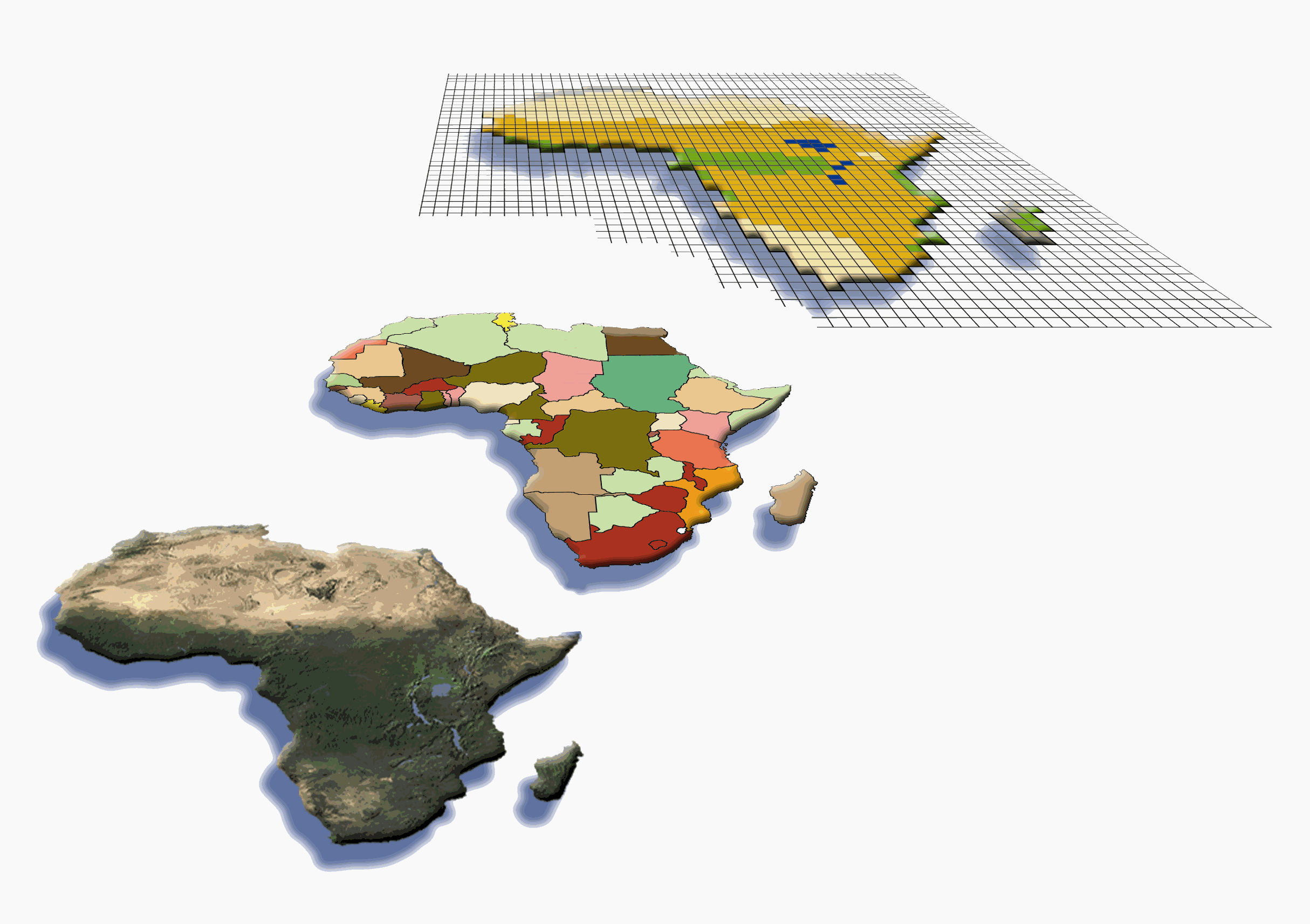
Maps are among the most important tools to represent the complex geographical distribution of migratory species, which varies with time. Migratory species occupy distant geographical areas during feeding or breeding, using specific migratory routes and 'stepping stones' for resting and feeding. Certain areas are often visited for a short time (only days), but might harbour great concentrations or even the total of a population. Geographical Information Systems (GIS) are ideal tools for storing such complex geodata. A GIS consists of a data bank and a system permitting the processing and analysis of spatial (geographical) data (Longley et al. 1999). Spatial data can be stored either as vector or as raster data (Figure 3.2), depending on the purpose of the analysis, but formats can be converted (cf. Couclelis 1992). Vector data need little storage space and consist of basic geometrical objects, such as polygons, lines or points. These objects have attributes stored in the database, such as the bibliographic reference for the map or a time code representing the months when an animal can be found within the respective area. In contrast, raster data subdivide the world into a regular grid, where each cell is connected to attribute data within the database. This concept is equivalent to the datasets resulting from raster counts and maps, as f.e. published in the EBCC Atlas of European Breeding Birds (Hagemeijer & Blair 1997). Studies on vegetation cover by remote sensing are another example of raster GIS application in biology. Though interchangeable, the different formats are normally handled with different GIS software. IDRISI is one of the better-known GIS systems for raster data, while ArcInfo or ArcView are used to handle vector data. Most maps entered into GROMS are based on simple geometry, and therefore were represented as points, lines or polygons within a vector GIS.
Once distribution maps or point data have been digitised, they can be visualised easily in different scales or projections. If data have a time-code (e.g. satellite data), they can be animated on-screen. Other map layers can be added, such as cities, rivers or contour lines, or distribution maps of other species. Raster images can be used as a background, such as satellite pictures used for some of the maps in the map section (Annex 2). Besides the low storage space, species distribution maps in vector format allow a number of interesting applications, such as:
|
Fig. 3.2: Examples of GIS datasets. below: Satellite picture, Note that GIS vector files require minimal storage space (10 kB), while the map pictures need several megabytes. |
Abb. 3.2: Beispiele für GIS Datensätze. Unten: Satellitenbild, GIS Vektordaten benötigen minimalen Speicherplatz (~10 kB), während Bilder von Karten mehrere Megabytes benötigen. |
| Main components of the GROMS information system | < Integration of geodata > | The relational database |
This document should be quoted as part of the publication "Riede, K. (2001): The Global Register of Migratory Species Database, GIS Maps and Threat Analysis. Münster (Landwirtschaftsverlag), 400 pp." + CD
by Klaus Riede